UN
1 Bridle Road
£ 210,000
Description
We don't have a Description for this property.
- Bedrooms
- 3
- Bathrooms
- 0
- Sqft
- 1,011.00
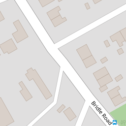
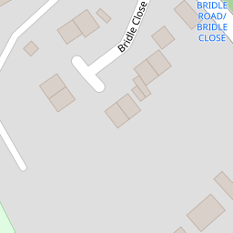


Leaflet © OpenStreetMap contributors
The heatmap indicates the level of crime in the area. The color of the heatmap indicates the crime severity and recency.
Metrics Year-on-Year
- Average area value
- 249,309.00 £Increased by 1.43 %
- Est sale value
- 260,838.00 £Increased by 5.31 %
- Average area rental value
- 1,005.00 £/moIncreased by 22.71 %
- Est letting value
- 1,011.00 £/mo
- Est rental Yield
- 4.84 %Increased by 21.00 %
- Crime Rate
- 3.00 %Unchanged by 0.00 %
from 245,789.00 £
from 247,695.00 £
from 819.00 £/mo
from 0.00 £/mo
from 4.00 %
from 3.00 %
Nearby Schools
| Name | Type | Ofsted | Distance |
|---|---|---|---|
| Christ The King Catholic Primary School | Voluntary Aided School | Good | 0.34 KM |
| Mendell Primary School | Community School | Requires improvement | 0.47 KM |
| Raeburn Primary School | Community School | Good | 0.75 KM |
| Bromborough Children'S Centre | Children's Centre | 0.79 KM | |
| Heygarth Primary School | Community School | Good | 0.94 KM |
Images
Nearby Streets
| Name | Average Price | Average Sqft | Distance |
|---|---|---|---|
| Howard Avenue | £ 249,950 | 0 | 0.00 KM |
| Briscoe Grove | £ 425,000 | 0 | 0.00 KM |
| Freestone Drive | £ 260,000 | 0 | 0.00 KM |
| Harrison Close | £ 279,375 | 0 | 0.00 KM |
| West House Close | £ 379,950 | 0 | 0.00 KM |
Nearby Transport
| Name | NLC | TLC | Distance |
|---|---|---|---|
| Bromborough | 2190 | BOM | 1.29 KM |
| Bromborough Rake | 2191 | BMR | 1.72 KM |
| Eastham Rake | 2128 | ERA | 1.87 KM |
| Spital | 2199 | SPI | 2.76 KM |
| Hooton | 2193 | HOO | 2.92 KM |
Nearby Listings
| Address | Price | Type | Score | Distance |
|---|---|---|---|---|
| Bridle Road, Bromborough | £ 220,000 | BUY | 6 / 10 | 0.00 KM |
| Bridle Park, Bromborough, Wirral | £ 114,995 | BUY | 5 / 10 | 0.18 KM |
| Bridle Park, Bromborough, Wirral | £ 149,995 | BUY | 5 / 10 | 0.18 KM |
| Bridle Park, Bromborough, Wirral | £ 160,000 | BUY | 7 / 10 | 0.18 KM |
| Allport Lane, Bromborough, CH62 | £ 335,000 | BUY | 7 / 10 | 0.18 KM |
Nearby Properties
| Address | Price | Distance |
|---|---|---|
| 1 Bridle Road | £ 210,000 | 0.00 KM |
| 15 Bridle Road | £ 137,500 | 0.00 KM |
| 19 Bridle Road | £ 125,000 | 0.00 KM |
| 27 Bridle Road | £ 195,000 | 0.00 KM |
| 25 Bridle Road | £ 144,500 | 0.00 KM |